WebNew
FlightScanAI agent
Ask for a traffic brief, watch emergency squawks, and let the agent track aircraft or change range without leaving the dashboard.
FlightScanAI shows what is flying near a point, right now—on a map or a round radar—with emergency alerts, callsign tracking, weather overlays, and an agent that can watch the sky with you.
A connected map, radar, and agent for nearby air traffic—now on the web, with a native iOS app that shares the same settings and data API.
Ask for a traffic brief, watch emergency squawks, and let the agent track aircraft or change range without leaving the dashboard.
The same live traffic as the map, projected onto range rings with an optional sweep—built for a fast look at nearby aircraft.
Look up a flight globally, keep it on screen even when it is outside range, and pause follow automatically when you pan.
FAA sectional tiles over a light base, alongside Dark, Light, and Voyager styles.
RainViewer radar overlay plus airport icons and runway centerlines from OurAirports.
Map, Radar, Traffic, and Settings with offline-friendly settings sync and sign-in (Google, Apple, or email).
FlightScanAI is a portal for what is flying around you—not a worldwide replay. Center, filter, watch, track, and ask the agent when something needs attention.
Polls adsb.fi and OpenSky, merges traffic in a bounding box, and refreshes about every 12 seconds on web and 15 seconds on iOS.
CARTO and FAA VFR sectional basemaps, rotating markers, optional airport icons, and flight paths that persist as you pan.
North-up dish with range rings, sweep, and the same alerts and tracks as the map—range +/− changes coverage, not camera zoom.
Lookup by callsign or registration. Out-of-range targets still plot. Follow recenters until you take the map back.
Emergency squawks on by default, optional military keywords, and a watch list of callsigns or types from settings.
Brief nearby aircraft, set watches for 7700s or coverage loss, and drive host actions like centering, ranging, and tracking.
Built for pilots, spotters, and operators who need a fast answer: what is in this range, right now, and does any of it need a closer look?
Use GPS, a typed lat/lon, or a tracked aircraft. Default center is KSFO until you choose otherwise.
Set range (2–30 mi), altitude band, minimum speed, and optionally hide ground vehicles.
Switch between map and radar. Paths use historical traces when available, otherwise a live poll trail.
Follow a callsign or registration worldwide. Follow pauses when you pan; resume from the tracking banner.
Open aircraft details, highlight emergencies, and ask the agent to watch the sky for you.
Emergency codes, optional military filters, and a watch list sit on top of the same ADS-B picture—then open a detail sheet for identity, type, and operator.
| Type | Description | Severity |
|---|---|---|
| 7700 | Emergency squawk in range | High |
| 7600 | Radio failure indicated | High |
| 7500 | Unlawful interference code | High |
| Watch | Callsign matched your watch list | Medium |
The agent can brief nearby traffic, watch for 7700s, and drive the dashboard—center, range, and track—without replacing your judgment.
Historical traces from OpenSky or adsb.fi when available; otherwise a dashed trail from recent polls so you still see where traffic has been.
Open an aircraft sheet for altitude, speed, type, registration, and operator enrichment—same sheet on map, radar, and the traffic list.
Run the full picture from the web, then keep the same settings and traffic model on iOS—Map, Radar, Traffic, and Settings tabs talking to one API.
FlightScanAI on the web is the command center: split map or radar, live list, hover cards, detail modal, settings, and the traffic agent.
Center on GPS or a typed location, then watch aircraft rotate with heading on Dark, Light, Voyager, or FAA VFR sectional basemaps.
The FlightScanAI mobile app is built for a glance on the ramp: Map, Radar, Traffic, and Settings, with the same traffic model as the web.
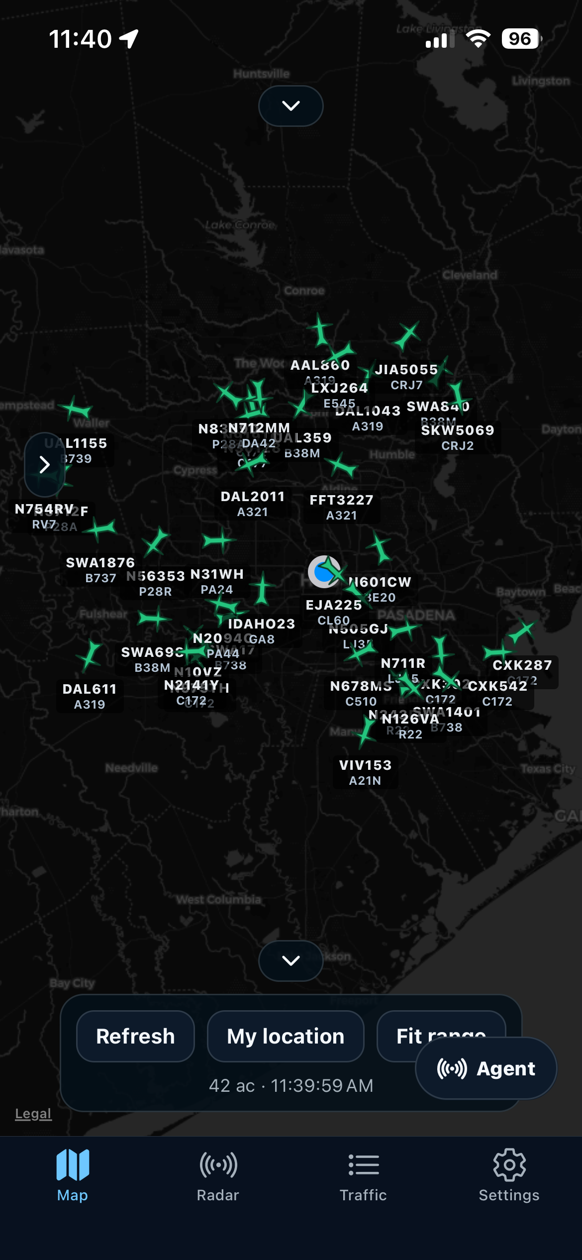
Collapsible style chips, my location, fit range, and live aircraft markers with the same settings as the web app.
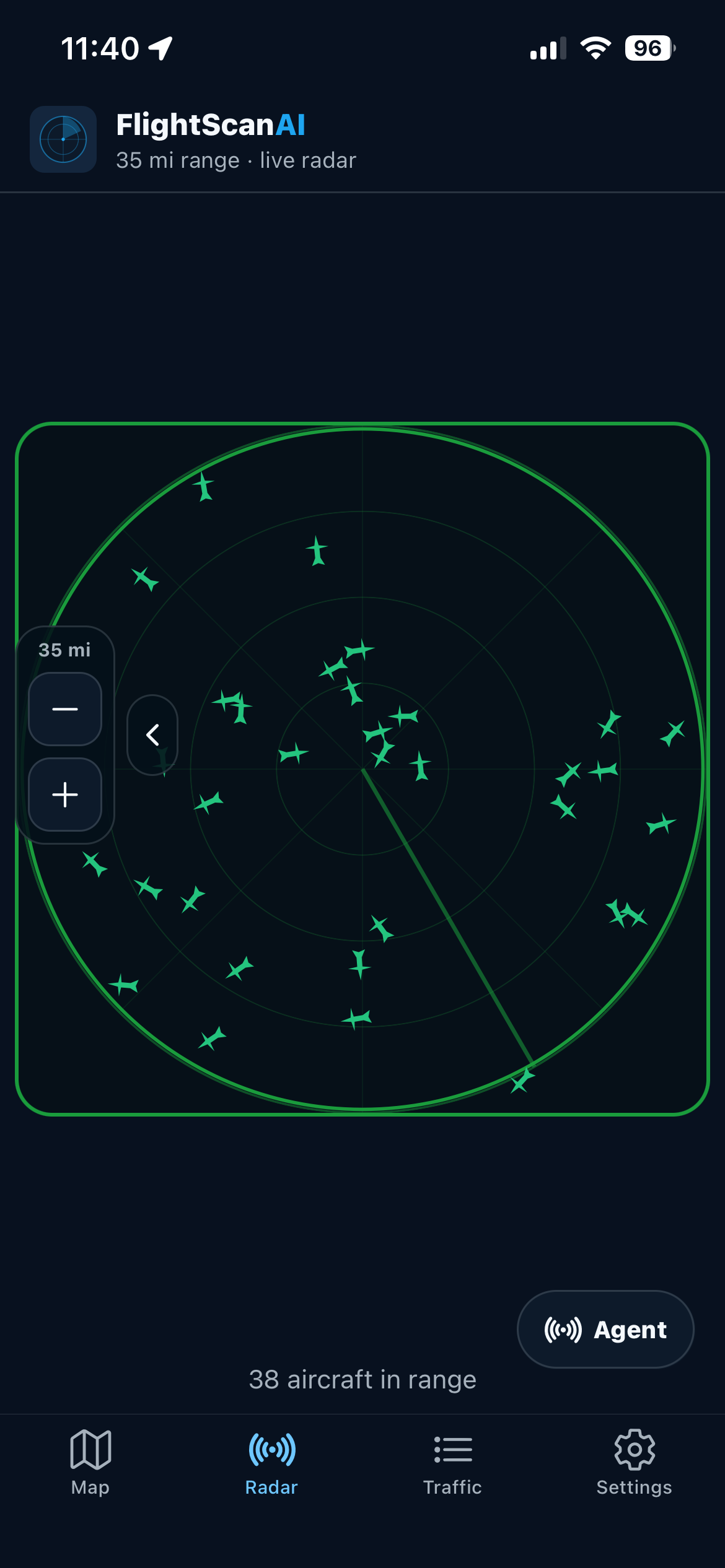
The dish fills the leftover screen. Range +/− sits under the display; tap a blip for altitude, speed, and distance.
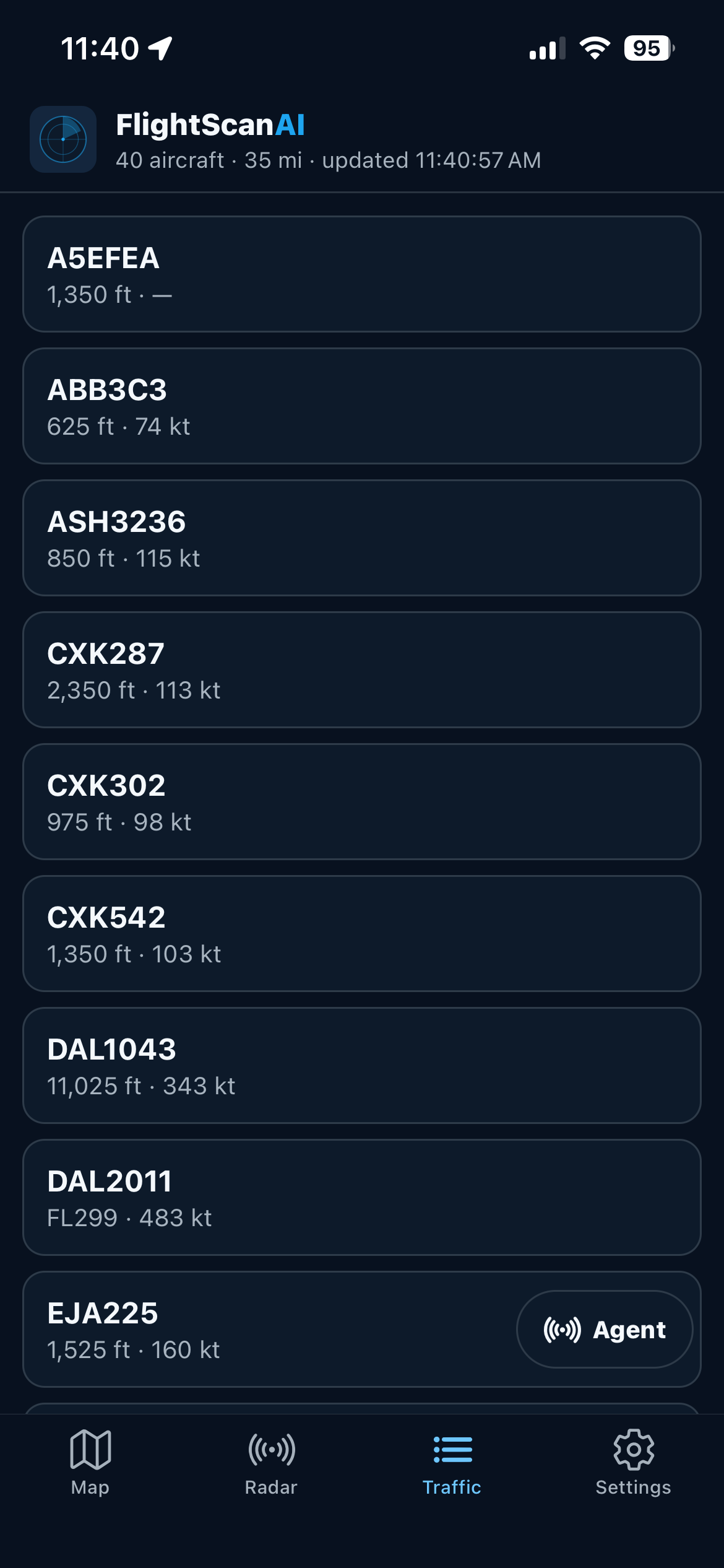
Scroll nearby aircraft, pull to refresh, and open the same detail sheet you get from the map.
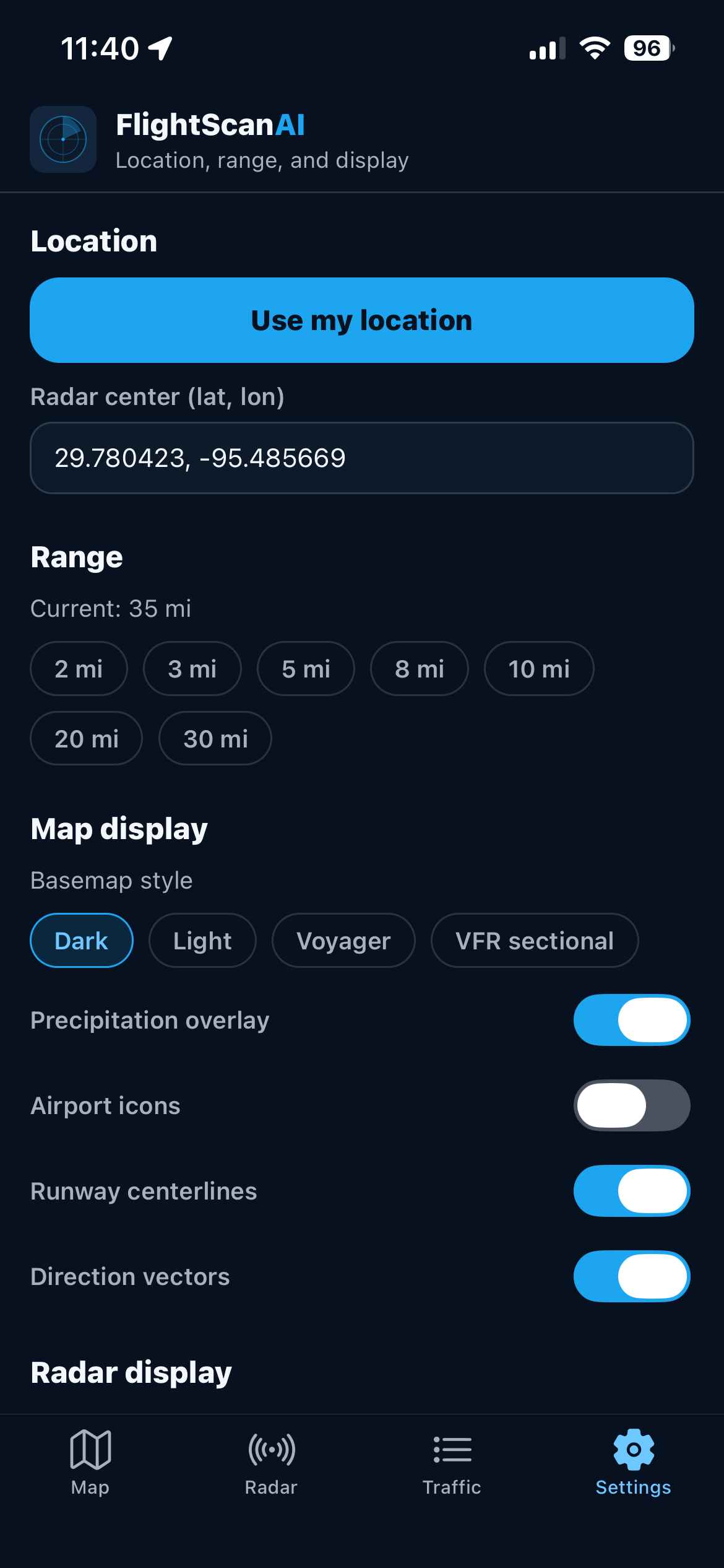
Location, range chips, overlays, radar chrome, alerts, tracked callsign, and account sign-out.
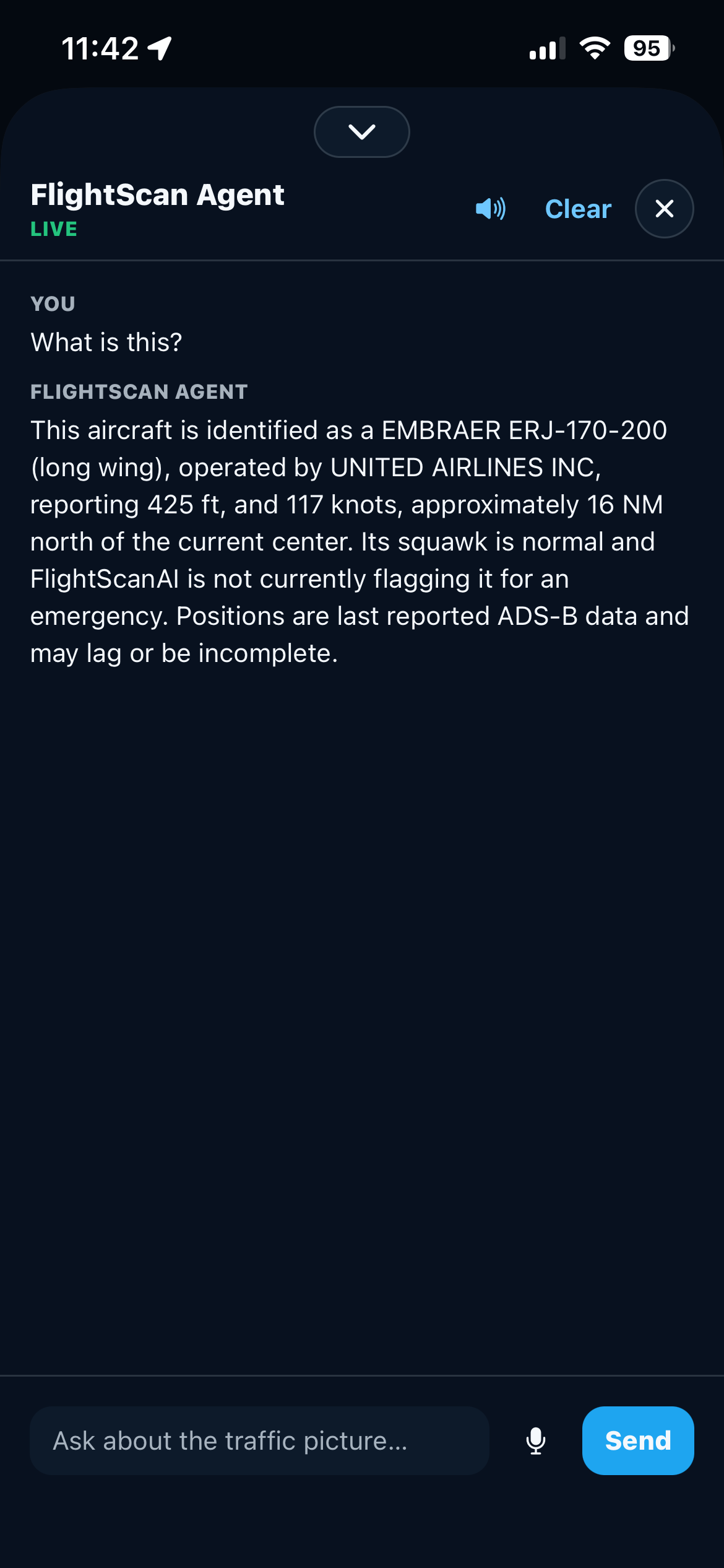
Ask for a traffic brief, watch emergency squawks, and drive map actions from a slide-over on Map or Radar.
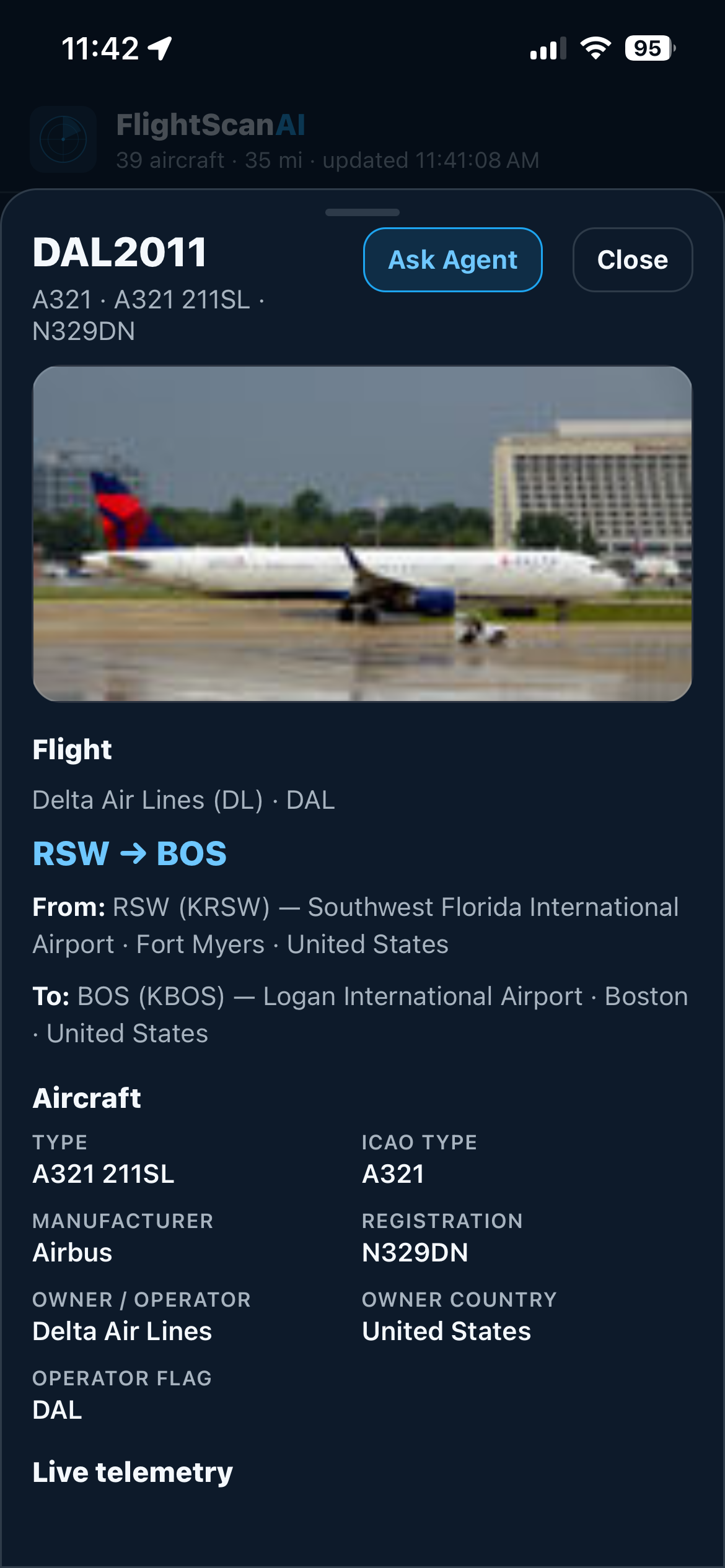
Identity, altitude, speed, type, operator, and photo—plus Ask Agent—from the same sheet as the web app.
Typical flight trackers emphasize a worldwide map. FlightScanAI is a local situational-awareness portal: range, radar, alerts, follow, and an agent—shared across web and iOS.
| Capability | FlightScanAI | Typical flight tracker |
|---|---|---|
| Local range map + round radar | ✓ | Map only |
| Emergency squawk highlighting | ✓ | Limited |
| Follow a callsign outside current range | ✓ | — |
| Conversational traffic agent | ✓ | — |
| FAA VFR sectional + precipitation overlay | ✓ | Varies |
| Shared settings across web and iOS | ✓ | Varies |
| Watch lists and military filters | ✓ | Limited |
| Historical traces plus live poll trails | ✓ | Limited |
Settings, range, alerts, and live traffic use the same rules on the dashboard and on the phone, so both stay in agreement.
FlightScanAI™ by Aviation AI Solutions LLC merges public ADS-B sources to show nearby aircraft. Positions, identities, and overlays can be incomplete or delayed. You remain responsible for see-and-avoid and for any operational decisions.
Tell us how you watch traffic—pattern work, ramp ops, spotting, or a custom range—and we will help you evaluate FlightScanAI.